
DigPilot Localizer
Countries are divided into several zones in the coordinate systems due to the earth's orbit and rotation. With DigPilot Localizer, your system will always register which zone you are in.
Unnecessary zones are filtered out by Localizer. DigPilot Localizer will detect projection and geoid model information in the project, and select it in the machine control accordingly.
Create your own projects
One of the many unique and innovative aspects of DigPilot is that you can create your own projects using only the DigPilot PC and the excavator.
Trench, wall, profile or a flatland and many more types of projects are easily specified according to your requirements by following the simple instructions that appear on the screen.
This can be done in both 2D and 3D.
The advantage of the 3D version is that you can use the GNSS to indicate exactly where in the world the project is using coordinates, so you do not have to reference the height every time you move the machine.
You can also make more complicated projects such as building pits, roads and ditches.
This means that you do not need to send project files in order to benefit from the DigPilot GNSS. Set out your own coordinates with the bucket and DigPilot draws the outer edges and the floor.
Creating your own projects directly in DigPilot 3D maximizes the yield of your rover even when you do not have project files available.
Create your own projects from A to B. Examples of projects:
Plane, Single/double slope, Trench ,building pit, Profile
... or set out an infinite number of points with the bucket make the DigPilot draw lines between them.
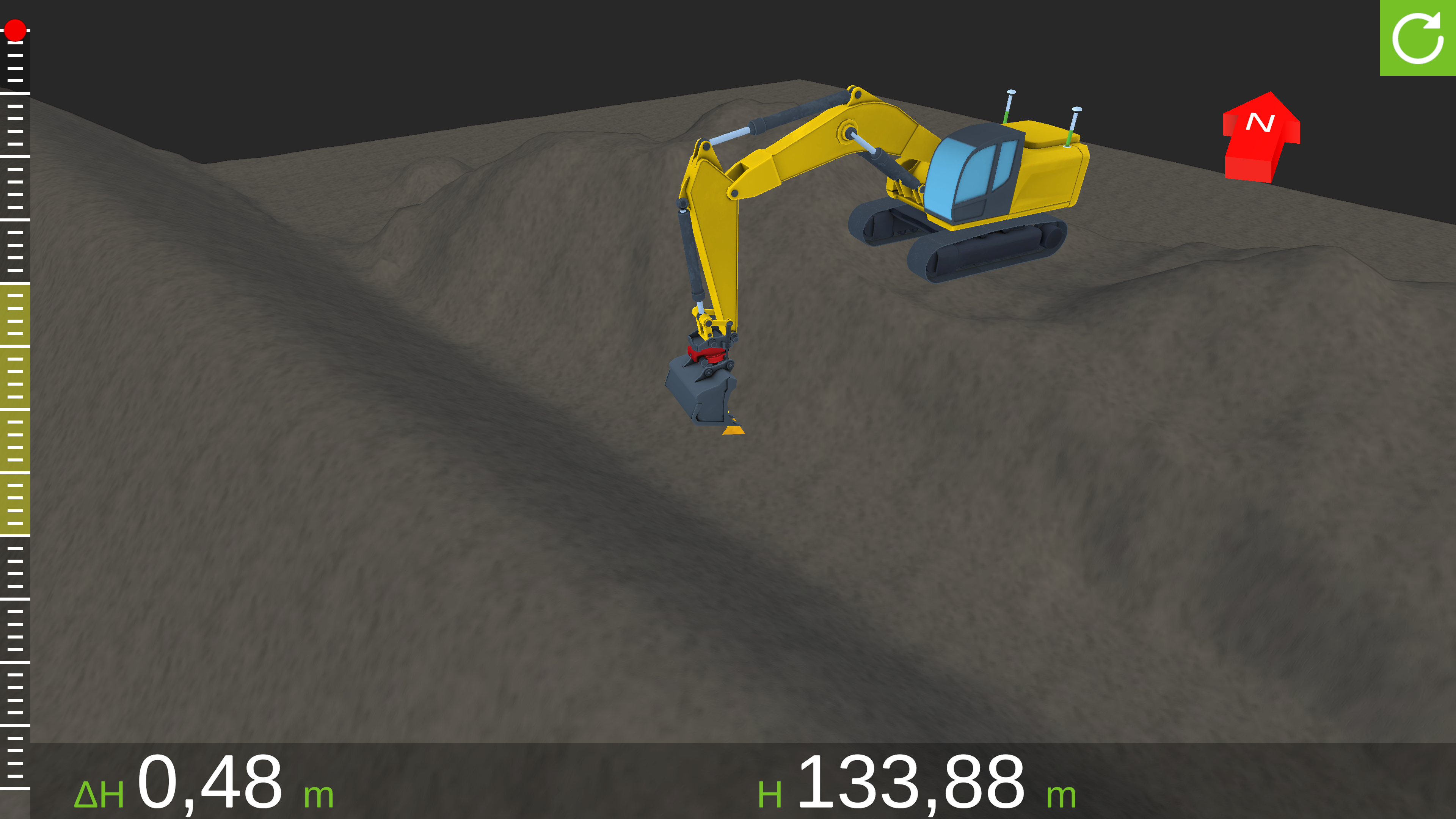
Full 3d view
One of the many unique and innovative aspects of DigPilot is that you can create your own projects using only the DigPilot PC and the excavator.
Trench, wall, profile or a flatland and many more types of projects are easily specified according to your requirements by following the simple instructions that appear on the screen.
This can be done in both 2D and 3D.
The advantage of the 3D version is that you can use the GNSS to indicate exactly where in the world the project is using coordinates, so you do not have to reference the height every time you move the machine.
You can also make more complicated projects such as building pits, roads and ditches.
This means that you do not need to send project files in order to benefit from the DigPilot GNSS. Set out your own coordinates with the bucket and DigPilot draws the outer edges and the floor.
Creating your own projects directly in DigPilot 3D maximizes the yield of your rover even when you do not have project files available.
Create your own projects from A to B. Examples of projects:
Plane, Single/double slope, Trench ,building pit, Profile
... or set out an infinite number of points with the bucket make the DigPilot draw lines between them.